Landscape Pattern Detection in Archaeological Remote Sensing
By Arianna Traviglia and Andrea Torsello
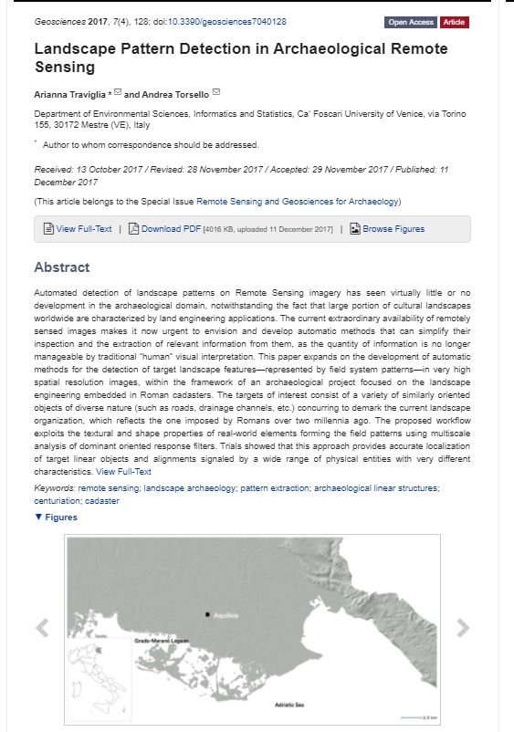
Automated detection of landscape patterns on Remote Sensing imagery has seen virtually little or no development in the archaeological domain, notwithstanding the fact that large portion of cultural landscapes worldwide are characterized by land engineering applications. The current extraordinary availability of remotely sensed images makes it now urgent to envision and develop automatic methods that can simplify their inspection and the extraction of relevant information from them, as the quantity of information is no longer manageable by traditional “human” visual interpretation. This paper expands on the development of automatic methods for the detection of target landscape features—represented by field system patterns—in very high spatial resolution images, within the framework of an archaeological project focused on the landscape engineering embedded in Roman cadasters. The targets of interest consist of a variety of similarly oriented objects of diverse nature (such as roads, drainage channels, etc.) concurring to demark the current landscape organization, which reflects the one imposed by Romans over two millennia ago. The proposed workflow exploits the textural and shape properties of real-world elements forming the field patterns using multiscale analysis of dominant oriented response filters. Trials showed that this approach provides accurate localization of target linear objects and alignments signaled by a wide range of physical entities with very different characteristics.
Tags: remote sensing; landscape archaeology; pattern extraction; archaeological linear structures; centuriation; cadaster.
Bibliographic Info: A. Traviglia and A. Torsello, 2017. Landscape Pattern Detection in Archaeological Remote Sensing. Geosciences, 7(4), 128; doi:10.3390/geosciences7040128
Publication Date: Dec 2017
| geosciences-07-00128.pdf | 3.92 M |
Finding common ground: human and computer vision in archaeological prospection
By Arianna Traviglia, Dave Cowley, and Karsten Lambers
The (slow) emergence of semi-automated or supervised detection techniques to identify anthropogenic objects in archaeological prospection using remote sensing data has received a mixed reception during the past decade. Critics have stressed the superiority of human vision and the irreplaceability of human judgement in recognising archaeological traces, perceiving a threat that will undermine professional expertise. However, as a number of published works and ongoing research demonstrate there are major benefits in developing this broad agenda. This paper provides a general review of the issues from a synergistic rather than competitive perspective, highlighting opportunities and discussing challenges
Tags: Object recognition, Object detection, Computer Vision, Remote Sensing, Digital Archaeology, Object Recognition (Computer Vision).
Bibliographic Info: Finding common ground: human and computer vision in archaeological prospection. AARGnews 53, 11-24
Publication Date: Sep 2016
| Finding common ground | 1.33 M |
Automated detection in remote sensing archaeology: a reading list
By Karsten Lambers and Arianna Traviglia
The applications of automated object detection in remote sensing archaeology have grown consolidating current perspectives at September 2016, and in support of the preceding paper on the broader issues of human and computer vision in archaeological prospection (Traviglia et al.).
Tags: Computer Vision, Object recognition, Object detection, Archaeological Remote Sensing, Aerial Archaeology, Digital Archaeology, .
Bibliographic Info: Lambers, K. and A. Traviglia, 2016. Automated detection in remote sensing archaeology: a reading list. AARGnews 53, 25-29.
Publication Date: Sep 2016
| Automated detection | 400 K |
Sensing tidal landscapes: artificial Intelligence and computer vision methods for underwater archaeological heritage in shallow waters

- Date: 8 September 2016
- Conference: International Congress of Underwater Archaeology IKUWA6 Celebrating our Shared Heritage, Fremantle WA (Australia), 28 November-2 December 2016
- Author: Arianna Traviglia
- Keywords: tidal landscapes, coastal environment, remote sensing, object detection, Aquileia-Grado Lagoon
Abstract
Remote sensing—intended as the methodology that uses aerial, radar and satellite imagery to pinpoint potential archaeological sites on landscapes or waterscapes—is being increasingly adopted as a critical component of the suite of research methodologies normally employed in the analysis of coastal and shallow aquatic/marine (lagoon or tidal) environments as its water penetration capabilities have long proved suitable for detection of underwater archaeological features. Depth limitation, water reflective properties and water turbidity are only partially limiting the discovery opportunities its use can provide and the advantages of its application over shallow waters in favourable circumstances are manifested.
A number of approaches in Pattern Recognition (PR) applied to aerial and satellite imagery of coastal tidal wetlands offer the opportunity to adopt classification methods to identify potential underwater archaeological features based on the automatic learning of patterns, regularities and shapes.
These approaches, which enable machine learning of patterns and the use of learned patterns for classification, can overcome the limitations of both simple optical recognition or previous methods based on automated pattern matching, and allow for recognising underwater patterns/shapes produced by a variety of natural or artificial elements.This paper will expand on some of the preliminary testing of this technique over the tidal landscapes of the Grado-Marano Lagoon (Italy), under which lays the southern fringes of the suburban development of Aquileia, one of the largest cities of the Roman Empire.
Why, when and how? Context and computer vision in archaeological prospection and interpretation

- Date: 31 March 2016
- Conference: CAA2016 Oslo Exploring Ocean of data, Oslo (Norway) 29 March-2 April 2016
- Authors: Dave Cowley, Karsten Lambers and Arianna Traviglia
- Keywords: object detection, automated detection, remote sensing, aerial archaeology
Abstract
As the session abstract identifies, the debate over applications of semi-automated or supervised feature extraction techniques in archaeology has tended to be polarised between believers and doubters. In large part the polarisation of discussion probably stems from a lack of explicitness about how archaeological feature identification is undertaken and how the processes, whether ‘automated' or ‘human', of identifying patterns, shapes and features interrelate with archaeological interpretation.
Furthermore, the varying contexts of these processes in multi-scaled archaeological prospection have not necessarily been defined as fully as they might.
Such ambiguity is unhelpful to exploration of the potential of new techniques, and the interfaces between traditional archaeological skills/knowledge and emergent tools. It also makes definition of common purpose difficult.
This paper will explore these issues, looking to address the reasons why the application of computer vision to archaeological prospection is vital, but also examining the workflows and outcomes of different approaches and processes, both manual and automated. These are important steps in addressing some key questions, including: how can we create clarity about why and when automated approaches are desirable? what are the roles of (traditional/manual) archaeological experience and skills in designing algorithms? and how can automated/manual approaches be used iteratively to improve archaeological detection?
Finding common ground: human and computer vision in archaeological prospection and interpretation.

- Date: 8 September 2016
- Conference: Aerial Archaeology Research Group Annual Conference AARG 2016, Pilsen, Czech Republic.
- Authors: Dave Cowley, Karsten Lambers and Arianna Traviglia
- Keywords: object detection, automated detection, aerial archaeology, remote sensing.
Abstract
Discussion of applications of semi-automated or supervised feature extraction techniques in archaeology benefits from explicitness about how and in which contexts archaeological feature identification is undertaken and how the processes, whether ‘automated’ or ‘human’, of identifying patterns, shapes and features interrelate with archaeological interpretation.
This paper will explore these issues, looking to address the reasons why the application of computer vision to archaeological prospection is vital, but also examining the workflows and outcomes of different approaches and processes, both manual and automated. Examples from other disciplines will shed light on how human and computer vision can be integrated in a transparent and efficient way, and how they can assist interpretation.
This will help to address some key questions, including: how can we create clarity about why and when automated approaches are desirable?; what are the roles of (traditional/manual) archaeological experience and skills in designing algorithms?; and how can automated/manual approaches be integrated to improve archaeological detection?
Sensing patterns: unveiling archaeological landscapes through Pattern Recognition in Remote Sensing

- Conference: Remote Sensing for Cultural Heritage: from site detection and documentation, to risk monitoring and mitigation, Earsel Workshop, Frascati (Rome, Italy), 12 - 13 November 2015
- Authors: Arianna Traviglia, Andrea Torsello
- Keywords: Artificial Intelligence (AI), Pattern Recognition (PR), classification, landscape patterning, centuriation, Aquileia (IT).
Abstract
Contemporary socio-economic pressure (including overexploitation and/or urbanisation of rural areas) and environmental processes (including climate change, coastal erosion etc) are determining the loss of cultural landscapes in Europe and all over the world.
Improved methodologies to study the processes that have shaped the landscapes over time are therefore crucial to understand and record the historical components of landscapes before these are irremediably lost or damaged, as well as to develop resilience and better define risk mitigation strategies.
Remote sensing is evidently one of the most appropriate and employed tools to tackle the challenge of systematically and rapidly identifying landscape features determined by anthropogenic processes and land engineering. While automated and semi automated procedures for feature extraction that allows for large swathe of landscapes to be simultaneously investigated are flourishing in many other fields, their application to archaeological and, more generally, cultural landscapes is still in its infancy – this limited development often determined by an uneasiness in surrendering the interpretation process to machine-based judgment.
This poster will illustrate an array of methods that are being used to automatically identify on remote sensing imagery landscape features and patterns determined by ancient Roman landscape engineering. Centuriation, the Roman system of land subdivision into large square plots assigned to settlers, continues to have a significant influence on present-day agrarian organisation in many locations across Europe and beyond.
A number of approaches in Pattern Recognition (PR) now offer the opportunity to adopt classification methods to identify potential land division elements based on the automatic learning of patterns and regularities in aerial and satellite imagery datasets. These approaches, which enable machine learning of patterns and the use of learned patterns for classification, can overcome the limitations of previous methods based on simple automated pattern matching and allow for recognising landscape patterns produced by a variety of diverse natural or artificial elements.
The poster will expand on some of the preliminary testing of this technique over the distinctively well preserved landscape surrounding the UNESCO Heritage site of Aquileia (Italy), one of the largest Roman land divisions in Italy.
Artificial intelligence or intelligent artifice? Breaking the stigma of automated detection over archaeological landscape patterning
- Conference: Aerial Archaeology Research Group Annual Conference AARG 2015, Santiago de Compostela (Spain), 9-11 September 2015
- Author: Arianna Traviglia
- Keywords: Artificial Intelligence (AI), Pattern Recognition (PR), landscape patterning
Abstract
The (limited) emergence of automated detection techniques to identify anthropogenic features over remote sensing imagery have received in the past mixed reception, with detractors stressing the superiority of human vision and the irreplaceability of human judgement in recognising archaeological features, and advocates clandestinely longing for the development of automated computer vision methodologies to streamline the screening of landscape imagery—the first group definitely outnumbering the second.
As a consequence, the analysis of remotely sensed images is still largely limited to imagery visual inspection (on screen or on prints) carried out by archaeologists and only marginal development of automated techniques for enabling screening of aerial and satellite imagery has been pursued by scholars. While automatically detecting features and patterns can produce questionable outcomes if not supported by human supervision and interpretation, automated techniques can in fact not only speed up analysis procedures, but reveal patterning in anthropogenic features that are hard or impossible to detect by visual inspection.
This poster will expand on methods for computer-aided identification of landscape patterns that are the result of complex ancient landscape engineering such as centuriation, the Roman system of land subdivision into large square plots assigned to settlers. A number of approaches in Pattern Recognition (PR) now offer the opportunity to adopt similarity-based approaches to identify potential land division elements based on the recognition of patterns and regularities in aerial and satellite imagery datasets.
This technique can overcome the limitations of previous methods based on simple automated pattern matching and help to identify landscape patterns formed by a variety of different natural or artificial elements. The poster will provide highlights on some of the preliminary testing of this technique over the centuriated landscapes of Roman Aquileia (Italy), one of the largest land divisions in Roman Italy up to the 2nd century BC. Using aerial and satellite coverage the technique is being used to automate procedures of similarly-oriented linear feature detection in the imagery and to replace feature extraction procedures based on subjective observation and interpretation.
Automation is here to stay! The hitch-hiker’s guide to automated object detection and image processing in remote sensing

- Date: March 2017
- Conference: CAA2017 Atlanta Digital archaeologies, material worlds (past and present), Atlanta (GA, USA) 14-16 March 2017
- Chairs: Arianna Traviglia, Dave Cowley
- Keywords: Feature extraction, Pattern recognition, Pattern matching, Classification, Mathematical Morphology, multispectral and hyperspectral imagery, ALS
Abstract
Automation is here to stay! Building on the 2016 CAA session in Oslo on Computer vision for automated object identification, this session aims to develop further the automation agenda for remote sensing image processing. We can see a willingness to engage with such approaches, often through applying techniques borrowed from other disciplines (such as medical imaging, face recognition, surveillance and security, social media) and the increasing power of computer vision techniques and machine learning approaches.
Amongst the many available methods that include tools based on (to name a few) deep convolutional networks (CNN), object-based image analysis, cognitive reasoning, self-learning algorithms and adaptive template matching there are convincing applications that overcome the earlier limitations of spectral and object-based methods and that they can enable the recognition of landscape patterns/objects produced by the near-unlimited assortment of forms, dimensions and spectral properties that mark soil-concealed anthropogenic remains.
This session offers a forum for practitioners of these new techniques, welcoming presentations on theory, experiences, and projects related to the theme of automatic object identification in archaeological remote sensing. We aim to highlight prospects and opportunities of the discipline, and discuss challenges ahead, regardless of the employed image datasets. Ideally, it also meant to bring together archaeologists and experts from other disciplines presenting methods that can be applied to the archaeological domain.
Themes of interests include, but are not restricted to:
● pattern recognition and pattern matching
● object-based image analysis
● deep convolutional networks (CNN)
● mathematical morphology
● emerging methods from other disciplines
Open open open. The rise of open scientific publishing and the archaeological discipline: managing the paradigm shift
- Date: March 2017
- Conference: CAA2017 Atlanta Digital archaeologies, material worlds (past and present), Atlanta (GA, USA) 14-16 March 2017
- Chairs: Arianna Traviglia, Xavier Rodier
- Keywords: Open publication, Open data, online repositories, publishing formats, intellectual property rights
Abstract
The field of scientific publishing is rapidly changing and evolving: numerous publishing experiments were conducted with varying degrees of success over the last two decades. The past few years have seen the emergence of the ‘Open Science’ movement, encouraging, among other practises, ‘open data’, ‘open publication’, and ‘open edition’.
All together, these initiatives have a transformative impact on the research and Higher Education communities, and are contributing to shatter and replace the existing scientific publishing paradigm, affecting the paid-for subscription model used by many scientific journals, and undermining the common practice of releasing reports under embargo. With all publicly funded scientific papers published in Europe targeted for free access – ensuring their full availability to and reuse by anyone – by 2020 (a deadline unrealistic for many), and other parallel initiatives in the USA (e.g. by NASA) the time for conversing about Open Access is now past and current discussion should concentrate on how we are going to achieve it in practice.
The domain of archaeological publication is not immune to these transformations and it is struggling to cope with the new challenges brought forth by this new paradigm. Although the archaeological discipline produces, for example, datasets with high reuse potential that are ideal for Open Content initiatives, its scholars are still pressed to publish peer reviewed articles in accordance to the standard academic practices, as national-level evaluation procedures for the assessment of University research quality have not yet fully incorporated measures of impact such as altmetrics, bibliometrics, semantics and webmetrics (‘Open metrics’).
Within the dominant discourse, the model that appears to many most suitable for the archaeological scholarship is one that publishes journal articles linked to open access datasets: this covers a spectrum of possibilities ranging from short, scholarly publications describing on-line accessible datasets to full papers that integrate datasets deposited in repositories (either as part of the journal or externally maintained).
These models, however, have varied acceptance. Despite their potentiality, for example, data papers growing popularity in other disciplines still does not seem to be reflected in the archaeological practise, where they do not receive appropriate recognition as they are not considered to meet the standards of ‘traditional’ scientific publishing.
Thus, besides a general agreement that Open Access enables reproducible scientific research, an ultimate and complete solution for all the data sharing and reuse issues has not been theorised yet. Held in conjunction with the official launch in Atlanta of the Open Access Journal of Computer Applications in Archaeology (JCAA), this session is intended to be a showcase and forum for theory, initiatives, experiences, proposals and projects related to the broader theme of Open Publishing in Archaeology, with the ultimate goal of using the discussion of the CAA community to help forge the future directions of the Journal.
Topics of interests include, but are not limited to:
- relationships between open publishing and open data/content and open repositories • relationships between scientific paper and data paper
- intellectual property rights or security/privacy issues
- interoperability of published data and the semantic web
- lessons learned (case studies)
- new publishing formats
- new scientific writing model.
Computer vision vs human perception in remote sensing image analysis. Time to move on
- Date: March 2016
- Conference: CAA2016 Exploring oceans of data, Oslo 29 March- 2 April 2016
- Chairs: Arianna Traviglia, Karsten Lambers
- Keywords: Feature extraction; Pattern recognition; Pattern matching; Classification; Mathematical Morphology; multispectral and hyperspectral imagery; ALS
Abstract
The (slow) emergence of semi-automated or supervised detection techniques to identify anthropogenic features over remote sensing imagery have received mixed reception in the past decade, with critics stressing the superiority of human vision and the irreplaceability of human judgement in recognising archaeological features, and supporters working toward the development of (semi)automated computer vision methodologies to streamline the screening of aerial/satellite imagery. This limited development has been due to a number of reasons, of which probably the most relevant are, on one side, an uneasiness of archaeologists in handing over –even partially– the interpretation process to machine-based judgment and, on the other, the fact that archaeological features can assume a near-unlimited assortment of shapes, sizes and spectral properties, which makes particularly challenging their auto-extraction. Thus, while (semi)automated and supervised procedures for feature extraction and processing are flourishing in a variety of fields, allowing for large swathes of landscapes to be simultaneously investigated, their application to archaeological and, more generally, cultural landscapes is still in its infancy.
A number of approaches in Feature extraction, Pattern Recognition, Pattern Matching, to name a few, now offer the opportunity to adopt (semi)automated feature detection and processing methods to identify potential archaeological features. These approaches can overcome the previous limitations of spectral and object-based methods and enable recognition of landscape patterns/features produced by a variety of diverse natural or artificial elements.
This session invites presentations showcasing computer-vision methods that are being used or developed to automatically identify landscape features and/or patterns on remote sensing imagery and it is –purposely– open to research employing broadly defined 'remote sensing data'. The session also welcomes controversial papers examining more broadly the subject from a theoretical point of view and addressing the topic from an antagonist angle.
Interview of MC fellow Arianna Traviglia on the VEiL project.
Interview of MC fellow Arianna Traviglia at the Querini Stampalia Foundation (Venezia) during the 'ART & SCIENCE SYMPOSIUM' 2015 organised by the DVRI.
#MEETTHERESEARCHER | ARIANNA TRAVIGLIA In occasione dei nostri Social Event invitiamo e incontriamo sempre i ricercatori dei nostri soci e tutti hanno davvero molto da raccontare. Vi presentiamo alcune delle loro storie: questa è Arianna Traviglia, Archeologa ma anche informatica, sognava di fare Indiana Jones da grande e ora lavoro come MSC FELLOW all'Università Ca' Foscari..." La bella intervista è stata fatta in Fondazione Querini Stampalia Venezia che ha ospitato l'ART & SCIENCE SYMPOSIUM del DVRI
Pubblicato da Distretto Veneziano della Ricerca e dell'Innovazione su Sabato 19 novembre 2016
| Il Gazzettino E Venezia attira le promesse della ricerca internazionale | 156 K |