Posters
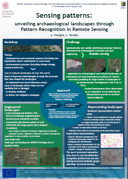
Sensing patterns: unveiling archaeological landscapes through Pattern Recognition in Remote Sensing
- Conference: Remote Sensing for Cultural Heritage: from site detection and documentation, to risk monitoring and mitigation, Earsel Workshop, Frascati (Rome, Italy), 12 - 13 November 2015
- Authors: Arianna Traviglia, Andrea Torsello
- Keywords: Artificial Intelligence (AI), Pattern Recognition (PR), classification, landscape patterning, centuriation, Aquileia (IT).
Abstract
Contemporary socio-economic pressure (including overexploitation and/or urbanisation of rural areas) and environmental processes (including climate change, coastal erosion etc) are determining the loss of cultural landscapes in Europe and all over the world.
Improved methodologies to study the processes that have shaped the landscapes over time are therefore crucial to understand and record the historical components of landscapes before these are irremediably lost or damaged, as well as to develop resilience and better define risk mitigation strategies.
Remote sensing is evidently one of the most appropriate and employed tools to tackle the challenge of systematically and rapidly identifying landscape features determined by anthropogenic processes and land engineering. While automated and semi automated procedures for feature extraction that allows for large swathe of landscapes to be simultaneously investigated are flourishing in many other fields, their application to archaeological and, more generally, cultural landscapes is still in its infancy – this limited development often determined by an uneasiness in surrendering the interpretation process to machine-based judgment.
This poster will illustrate an array of methods that are being used to automatically identify on remote sensing imagery landscape features and patterns determined by ancient Roman landscape engineering. Centuriation, the Roman system of land subdivision into large square plots assigned to settlers, continues to have a significant influence on present-day agrarian organisation in many locations across Europe and beyond.
A number of approaches in Pattern Recognition (PR) now offer the opportunity to adopt classification methods to identify potential land division elements based on the automatic learning of patterns and regularities in aerial and satellite imagery datasets. These approaches, which enable machine learning of patterns and the use of learned patterns for classification, can overcome the limitations of previous methods based on simple automated pattern matching and allow for recognising landscape patterns produced by a variety of diverse natural or artificial elements.
The poster will expand on some of the preliminary testing of this technique over the distinctively well preserved landscape surrounding the UNESCO Heritage site of Aquileia (Italy), one of the largest Roman land divisions in Italy.
Artificial intelligence or intelligent artifice? Breaking the stigma of automated detection over archaeological landscape patterning
- Conference: Aerial Archaeology Research Group Annual Conference AARG 2015, Santiago de Compostela (Spain), 9-11 September 2015
- Author: Arianna Traviglia
- Keywords: Artificial Intelligence (AI), Pattern Recognition (PR), landscape patterning
Abstract
The (limited) emergence of automated detection techniques to identify anthropogenic features over remote sensing imagery have received in the past mixed reception, with detractors stressing the superiority of human vision and the irreplaceability of human judgement in recognising archaeological features, and advocates clandestinely longing for the development of automated computer vision methodologies to streamline the screening of landscape imagery—the first group definitely outnumbering the second.
As a consequence, the analysis of remotely sensed images is still largely limited to imagery visual inspection (on screen or on prints) carried out by archaeologists and only marginal development of automated techniques for enabling screening of aerial and satellite imagery has been pursued by scholars. While automatically detecting features and patterns can produce questionable outcomes if not supported by human supervision and interpretation, automated techniques can in fact not only speed up analysis procedures, but reveal patterning in anthropogenic features that are hard or impossible to detect by visual inspection.
This poster will expand on methods for computer-aided identification of landscape patterns that are the result of complex ancient landscape engineering such as centuriation, the Roman system of land subdivision into large square plots assigned to settlers. A number of approaches in Pattern Recognition (PR) now offer the opportunity to adopt similarity-based approaches to identify potential land division elements based on the recognition of patterns and regularities in aerial and satellite imagery datasets.
This technique can overcome the limitations of previous methods based on simple automated pattern matching and help to identify landscape patterns formed by a variety of different natural or artificial elements. The poster will provide highlights on some of the preliminary testing of this technique over the centuriated landscapes of Roman Aquileia (Italy), one of the largest land divisions in Roman Italy up to the 2nd century BC. Using aerial and satellite coverage the technique is being used to automate procedures of similarly-oriented linear feature detection in the imagery and to replace feature extraction procedures based on subjective observation and interpretation.
Last update: 17/04/2024

