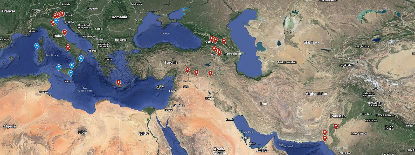
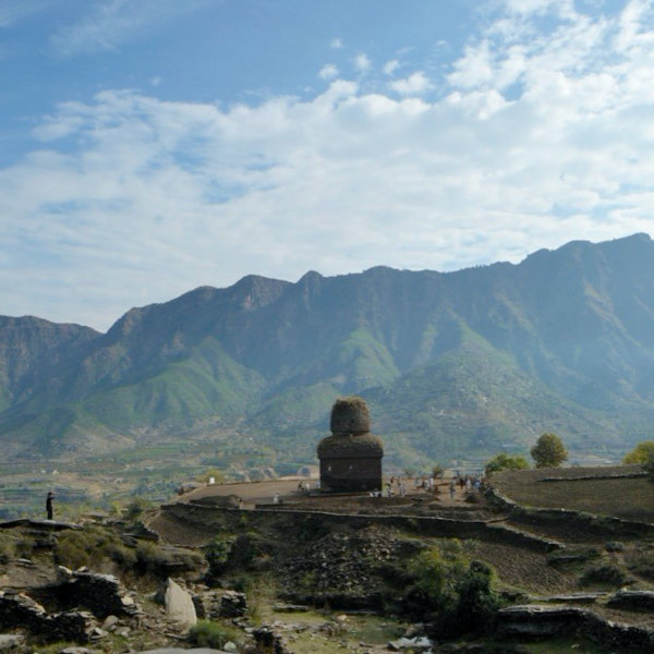
Khyber PATH (Professions for climate Adaptation ecoTourism and Heritage)
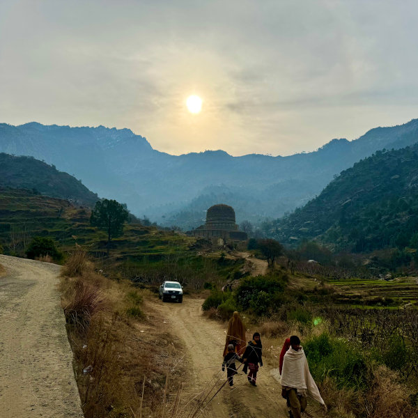
This 3-year project (2025-2028) focuses on the archaeological area from the Swat Valley to Taxila (northern Pakistan). It is funded with € 3.000.000,00 by the Italian Agency for Development Cooperation and led by the Department of Asian and North African Studies (DSAAM) of Ca’ Foscari University of Venice, with the ISCOS INGO as implementing partners at the local level, and the Directorate of Archaeology and Museums of Khyber Pakhtunkhwa (KP) as Pakistani counterpart.
Considering the invaluable potential of cultural and natural heritage in the development of KP Province (northern Pakistan) and the high vulnerability of the region to climate change and natural disasters, including floods and their consequent economic difficulties, the archaeological component of this large project focuses on the excavation, restoration, musealisation and promotion of designated archaeological sites in the rural areas of KP Province to ensure, on the one hand, the thorough documentation and preservation of these sites and, on the other hand, to promote inclusive and sustainable economic growth of communities in the KP by enhancing ecotourism.
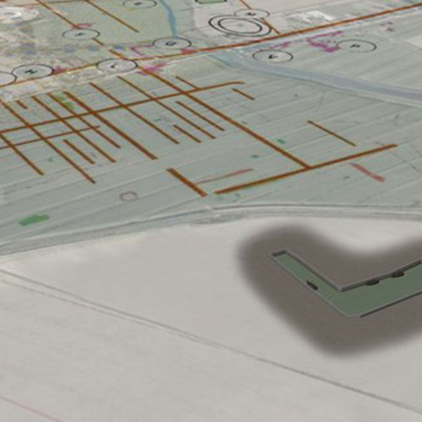
Specifically, the initiative extends from the Swat Valley to the archaeological area of Taxila (KP Province), around an integrated route (approximately 125 km) that connects eight archaeological sites (spanning from Prehistory to early Medieval period) via ancient roads and paths. The eight sites that are the focus of the activities are: the ancient city of Barikot (Swat district); the ancient path from Gumbat (Swat district) to Hati Lar (Malakand district); the temple of Zalamkot and the ancient city of Palai (Malakand district) and Thareli (Mardan district); Asota (Swabi district) Jandial Temple and the ancient city of Sirsukh at Taxila (Hazara district).
For further information please visit www.unive.it/khyberpath [ITA].
Archaeologies of crisis: urban and religious transformations of NW South Asia in late antiquity
The Rita Levi Montalcini project ‘Archaeologies of Crisis’ (2024-2027) aims to develop an integrated model of the urban and religious transformations that took place in the Swat Valley (northern Pakistan) in late antiquity, by intersecting three different disciplinary fields: urban archaeology, religious studies and palaeoscience. Specifically, this project proposes to consider as overlapping and interconnected three phenomena hitherto analysed separately in scholarship:
- the urban crisis or the shift to a new concept of the urban
- the “Late Antique Little Ice Age”, occurred between 536 and 660 CE
- the emergence of an alternative form of Buddhist doctrine, Vajrayana Buddhism, and the simultaneous rise in power and monumentalisation of Brahmanical religions.
The aim is to understand, on the basis of empirical and theoretical analysis, the degrees of variation, on a regional and local scale, of the human response to the pressure of climatic and environmental change in terms of socio-cultural structures, religious systems and economic sustainability.
Besides the creation of an archaeological map and database for Late Antique Swat, the project draws on the results of excavations conducted at late antique sites by the Khyber PATH project, as well as the results of excavations at the Buddhist sanctuary of Butkara I directed by the responsible of this project within the framework of the ISMEO/Ca’ Foscari-Italian Archaeological Mission in Pakistan.
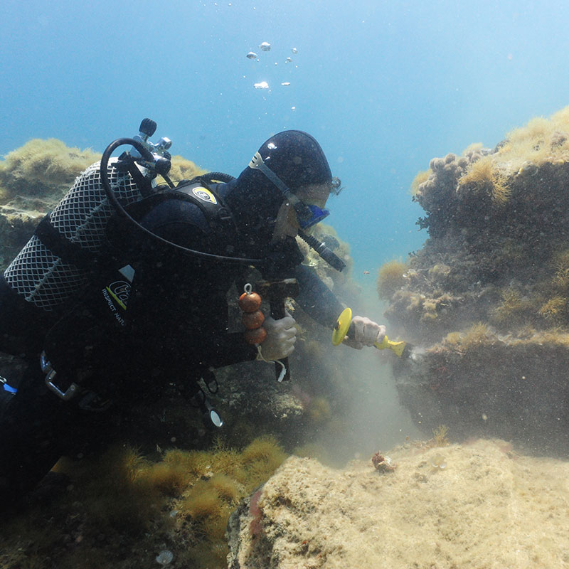
Deep-sea archaeology
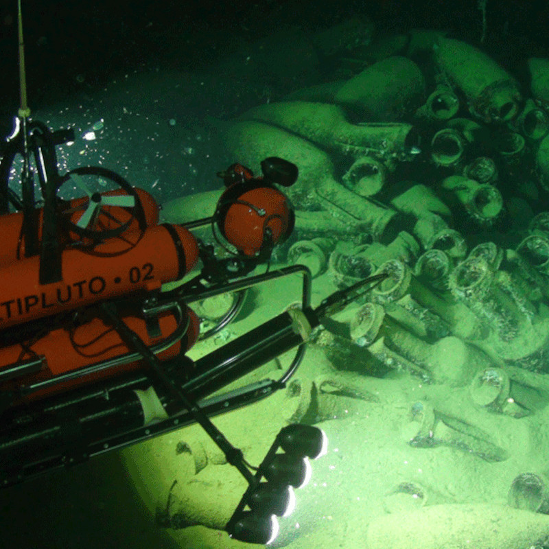
The project, conducted with Dr. Elisa Costa in collaboration with the Fondazione Azione Mare [ITA], aims to investigate Greek and Roman shipwrecks at great depths using deep-sea ROVs capable of performing underwater photogrammetry and some salvage operations.
Currently under investigation are a wreck with a cargo of tiles and late Republican amphorae located off the coast of Pianosa, a cargo of lithic blocks and Dressel 2-4 amphorae, a cargo of Dressel 1 and Lamboglia 2 amphorae, and a cargo of Greco-Italic amphorae located off the island of Capraia. The study of the tile cargo is being conducted by PhD student Caterina Tomizza.
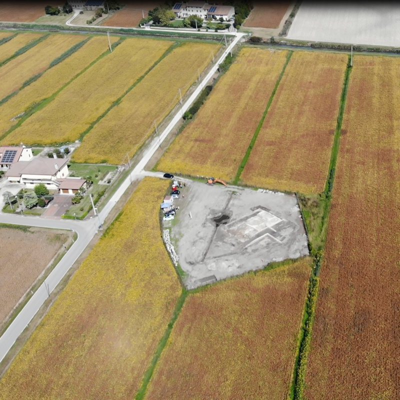
The Porto Sepolto. Archaeological excavation of the Etruscan settlement of San Basilio di Ariano nel Polesine (Rovigo)
The aim of the project, in collaboration with the University of Padua, the Soprintendenza ABAP for the provinces of Verona, Rovigo and Vicenza and the Polo Museale del Veneto, is to bring to light the ancient Etruscan and Greek settlement founded at the beginning of the 6th century B.C., precisely in relation to the reactivation of the Adriatic routes and at the same time of the river navigation of the Po trade axis.
After more than thirty years since the interruption of investigations, the resumption of the excavations is a starting point for the deepening of knowledge on the Adriatic dynamics in the Archaic and Late Archaic periods.
Moreover, the project has significant value in terms of 'Participatory Archaeology', since a significant share of the activities is intended for interaction with the inhabitants of Ariano, with the scholastic world, with local institutions aimed at enhancing the heritage, such as the Po Delta Park and the Polo Museale del Veneto, as well as the design of tourist itineraries within the framework of slow and experiential tourism.
Altino port system
The project aims to reconstruct the port and waterway system of the Roman city of Altino through investigations conducted both in Valle Rossa, i.e., in the area of the large L-shaped dock (urban port), and within the ancient city. In the latter area, particularly around the monumental landing gate, core sampling is being conducted to reconstruct the flow, width, depth, and characteristics of the waterways.
The research involves PhD student Elisabetta Rosatti, Prof. Paolo Mozzi, a geologist at the University of Padua, and Adele Bertini, a palynologist of the University of Florence.
The investigation approach takes particular account of the reconstruction of the paleoenvironment and the relative variations in the sea. The investigation techniques are developing digital photogrammetry in very low visibility.
Italian Archaeological Mission in Pakistan
The Mission was founded in 1955 and has been continuously active ever since, working mainly in the Swat Valley.
It is a permanent institution with guesthouse, library, archaeological storerooms and camps.
The field of study ranges from pre-historic and proto-historic archaeology to Islamic and medieval periods.
Traditionally, much space has been given to research into the archaeology of Buddhism.
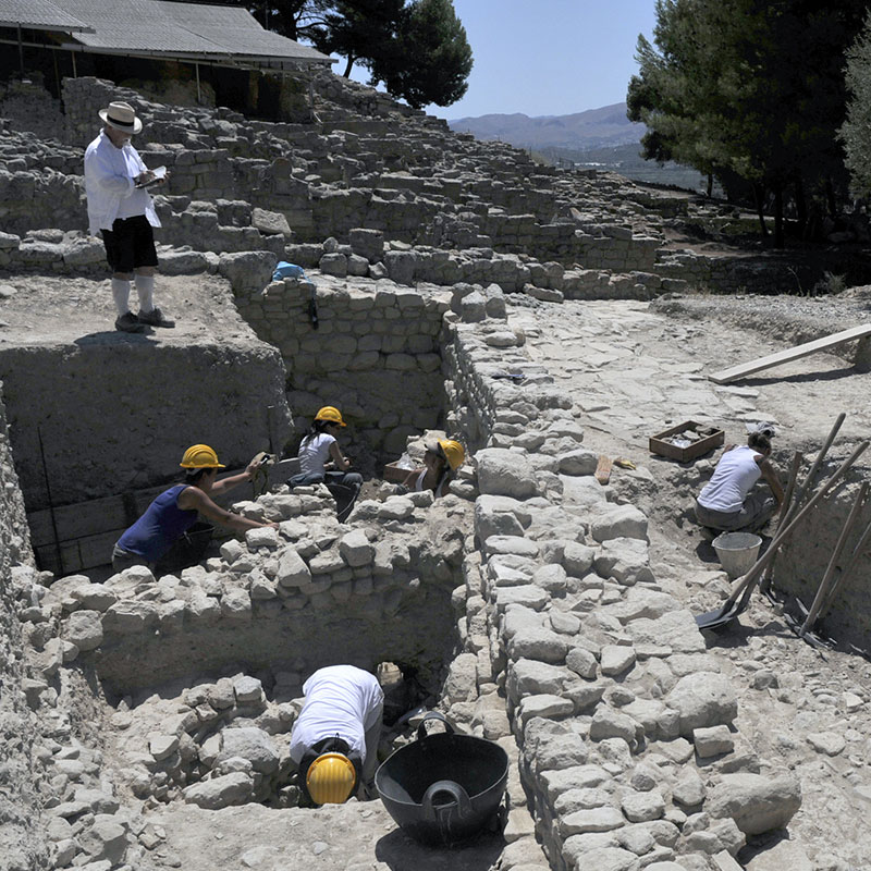
The Mission is currently excavating the multi-phase urban site of Barikot (1700 BC - 1500 AD), which is now in its 21st excavation campaign in 2021.
Other projects include glass production, the ancient genome between 1200 BC and the Middle Ages, and bio-archaeological research in the field of agriculture, climate studies and nutrition.
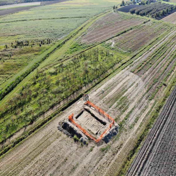
The Italian Archaeological Mission in Pakistan (Swat), co-managed from this year by Ca’ Foscari University of Venice along with ISMEO, continues the excavations, started in 1984, in 2020 in the ancient urban site of Barikot (Vajirasthana), known as Bazira or Beira by Alexander's historians). The excavation and the Mission are directed by L.M. Olivieri (Ca’ Foscari).
Strategically located in the centre of the Swat Valley on the foothills of the Hindukush, ancient Barikot has revealed an almost continuous sequence of occupation from 1700 BC to pre-modern times. Excavation until 2018 focused on the lower town, where it exposed two hectares (just under a fifth) of the city. This part of the site was continuously occupied from 500 BC to 300 AD, with its walls built in the Indo-Greek phase (c. 150 BC). Since 2019, the excavation has moved to the acropolis, already investigated in 1998-2000, where the excavation of a Visnuite temple founded at the time of the Shahi of Kabul (c. 700 AD) is being completed, of which the monumental podium (over 20 metres long), plastered with decorated pilasters, and marble fragments of statues, relating to the late phase of the building (Hindu Shahi dynasty, c. 850-1000 AD), remain. This year the focus was on the top of the acropolis with the excavation of a guard tower from the Ghaznavid era (11th century) and the monumental cistern of the Shahi temple. The complex stratigraphy of the steep slope is currently revealing underlying structures from the Kushan and earlier periods. These in turn have eroded protohistoric levels, revealed by artefacts and pottery found in the fill of the 1st-3rd century buildings.
Starting in 2024, the mission will also be carrying out excavations in the area of the Buddhist sanctuary of Butkara I (Swat).
Beyond Aquileia:
Roman camps in the Trieste area (2nd-1st century B.C.)
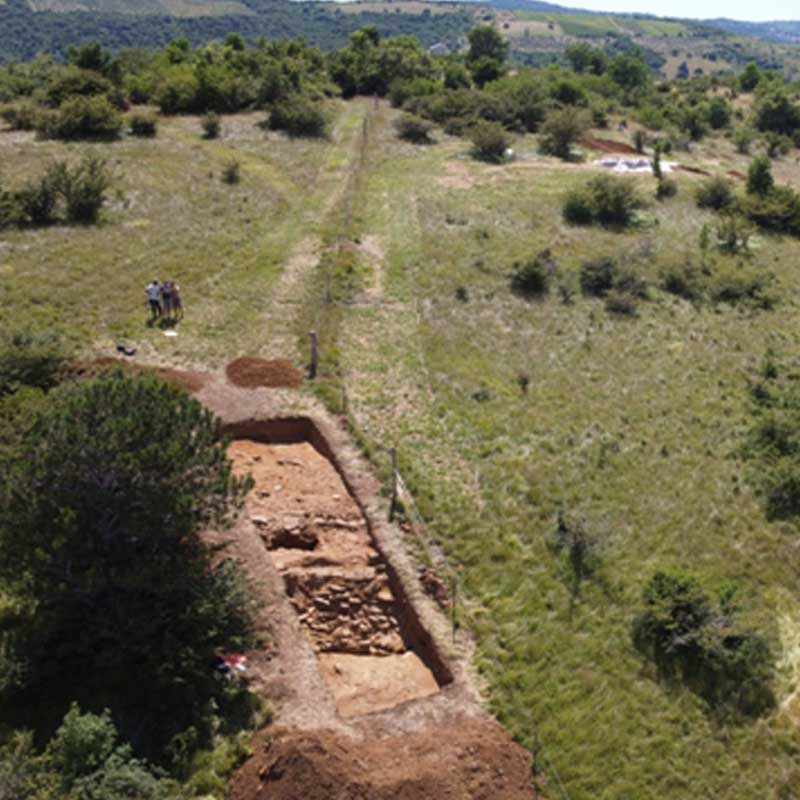
The project, initiated in 2012 as a result of a collaboration between ICTP (UNESCO), the University of Trieste and the Institute of Archaeology of the Slovene Academy of Sciences and Arts (SAZU), aims to further the knowledge about a group of republican military fortifications that were identified not far from Trieste thanks to laser remote sensing from an aerial platform. These structures are particularly interesting because they offer the opportunity to study the Roman military architecture of the republican age, evidenced, for the 2nd century B.C., almost exclusively by a few sites on the Iberian peninsula. After a series of surface reconnaissance, geophysical surveys and the first excavations carried out in 2019, the research planned for 2021 and 2022 will focus on the large, fortified complex (> 13 hectares) located on the hill of San Rocco, probably built during the Second Istrian War of 178-177 BC.
Festòs:
from the Neolithic village to the Roman countryside. Forms and development of an inhabited area
Within the project: "Festòs: from the Neolithic village to the Roman countryside. Forms and development of an inhabited area”, in 2022 will take place the first year of a five-year excavation cycle (2022-2026). Ca’ Foscari, in collaboration with the University of Catania, will carry out an excavation in the area of the Palazzo di Festòs and precisely in the area west of the tourist area, which has not been investigated so far. In its northern stretch, more on the slope, landslides have in fact led to the exposure of the oldest levels: from the north to the south, geometric levels, Middle Minoan III colmata and Middle Minoan II houses. These levels are related to those already investigated by Vincenzo La Rosa immediately to the East and allow to clarify some of the problems left open, such as the problem of residency, episodic or stable, of the communities of individuals who frequented the Palace and the presence of any non-residential structures (handcraft or representative).
Settlement dynamics and navigation in the Venice lagoon in Roman times
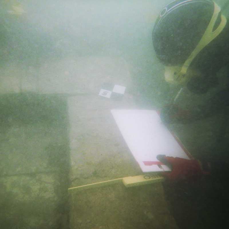
The project, supported by NRRP funding for the CHANGES Spoke 1 project and the PRIN 2022 project "The lagoon of Venice in Antiquity. Settlement dynamics, adaptive behaviors, paleoenvironmental reconstructions", aims to reconstruct settlement patterns, navigation, and the environment in the northern lagoon of Venice during the Roman era. Investigations are being conducted using both underwater archaeology techniques and in "wet" conditions. Currently, thanks also to the close collaboration with Prof. Paolo Mozzi of the University of Padua, the submerged sites of the "Roman tower" of the Canale San Felice, the Roman pier of Ca' Ballarin, and the Roman "villa" of Lio Piccolo (Tre Porti) have been investigated. Investigations are focusing in particular on the latter site, which has yielded a vivarium for keeping oysters alive from the 1st century AD and the foundational remains of a prestigious residence. The work is being conducted in collaboration with Dr. Elisa Costa.
KarstScape project
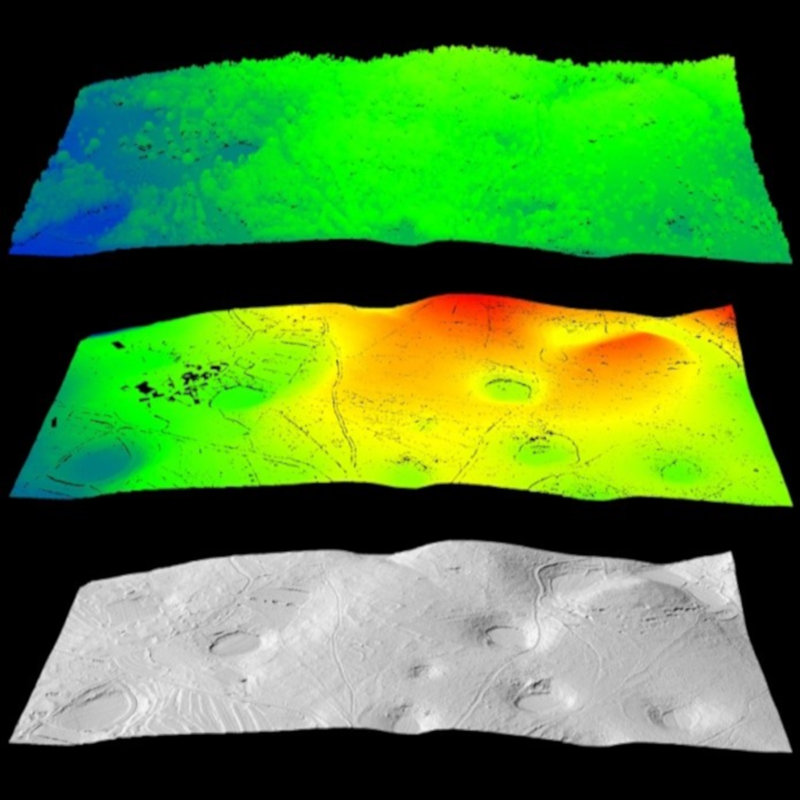
The interdisciplinary project KarstScape aims to reconstruct the evolution of the ancient landscape of Karst (Italy and Slovenia) from the prehistoric to the post-Roman period on the basis of surface reconnaissance, data generated by remote sensing (including LiDAR; SfM photogrammetry; ground-based remote sensing methods), archaeological excavations and scientific analysis of artefacts and ecofacts. This is the evolution of the Collaboration agreement for the development of advanced scientific technologies for the knowledge, protection and enhancement of the archaeological evidence and ancient landscape of the Friuli Venezia Giulia region (2016-2018), agreed between ICTP (UNESCO), University of Trieste and the Soprintendenza Archeologia, belle arti e paesaggio del Friuli Venezia Giulia. The research currently underway focuses on the study of protohistoric territorial organisation, centuriation and the Roman road system.
Between the mountain and the river. In search of tumuli hidden in the forest Georgian-Italian Lagodekhi Archaeological project (GILAP)
Georgian-Italian Lagodekhi Archaeological project (GILAP)
Georgian-Italian Lagodekhi Archaeological project (GILAP)
The project, coordinated by Elena Rova in collaboration with the Municipality and Museum of Lagodekhi (Kakheti Province, East Georgia) has been active since 2018. It envisages a surface reconnaissance with the aim of mapping the sites of archaeological interest in the municipality, located between the foothills of the Greater Caucasus and the Alazani River Valley, as well as excavations and surveys in several sites to study the evolution of human settlement in the territory.
The area is mainly known for the presence of monumental tumulus tombs (kurgan) from the second half of the 3rd millennium BC, which are currently buried in a dense forest, and numerous Chalcolithic (5th-4th millennium BC) and Late Bronze Age sites. The excavation has so far concentrated on the Chalcolithic settlement of Tsiteli Gorebi 5.
The approach is multi- and interdisciplinary: the excavation uses microarchaeological techniques and is accompanied by palaeoenvironmental and archaeometric research. Italian and Georgian researchers, students, postgraduates and doctoral students, as well as international experts, participate in the annual campaigns.
Ancient Masters of Georgia
Discovering viticulture and metallurgy between the Caucasus and the Near East
The project, coordinated by Elena Rova in collaboration with the Georgian National Museum in Tbilisi, focuses on the ancient pre- and proto-historic cultures of the Shida Kartli region, the historical heart of Georgia, the mythical land of the 'Golden Fleece', in the South Caucasus. The chronological period investigated spans from the Late Chalcolithic period to the Iron Age (4th-1st mill. BC).
The sites investigated from 2009 to 2017 were Natsargora, Okherakhevi, Aradetis Orgora and Doghlauri.
The excavation, which took a multidisciplinary approach and made use of microarchaeological techniques, was accompanied by the study of materials preserved in local museums and palaeoenvironmental and archaeometric research.
The materials found are currently being studied (including as part of degree or doctoral theses) and laboratory analyses are continuing with a view to the final publication of the excavations.
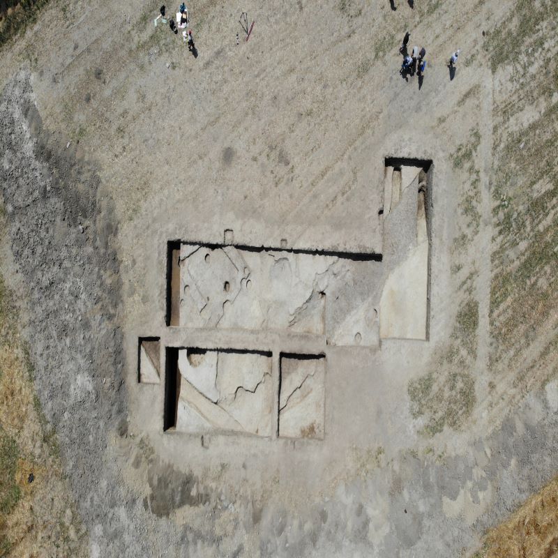
In search of Venice's ancestors: the Altino excavation
Lo scavo di Altino
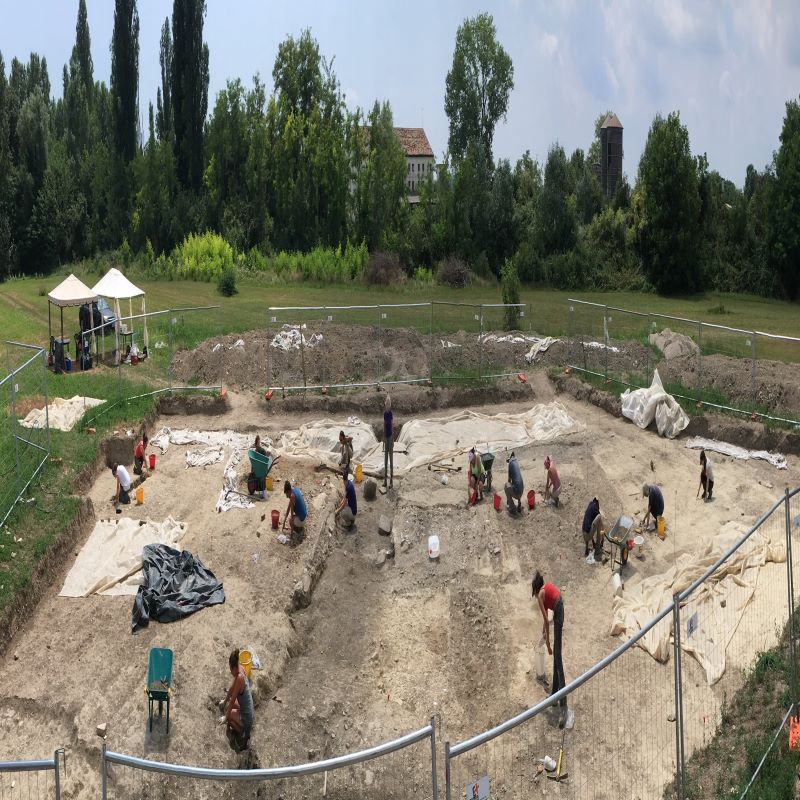
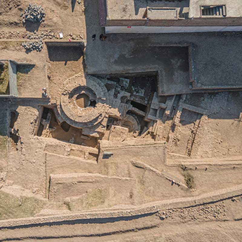
The Roman city of Altino was the first important center in the lagoon that took its name from Venice: like the previous Paleovenetian settlement, and as Venice would later be, it was a meeting point between the sea routes and the mainland. Recent aerial photography has shown that the Roman city had an impressive monumental structure, with a forum, a major theater, a minor theater, an amphitheater, and a large canal crossing the city. Since the first campaign (2016), excavations at Ca' Foscari have focused on the area east of the monumental center, known as Campo Rialto. In recent campaigns, the remains of two large domus, dating from the late Republican period, and an imposing apse-shaped building, the function of which remains unclear, have been brought to light. Among the materials discovered, a large quantity of painted plasters stands out, dating mainly from the second half of the 1st century AD and the beginning of the following century, which can be compared with other complexes of the 10th regio, and which demonstrate the richness and refinement of the decorative apparatus of Altino.
Land of Mosul
Settlement, landscapes and material culture of northern Iraq in the Islamic period
The project aims to study a large area of the Mosul plain, in the north of present-day Iraq, from the Arab conquest in the 7th century until the beginning of the 20th century.
Directed by C. Tonghini, it is part of a wider programme of research in the region, from prehistory to the present day, coordinated by the University of Udine.
Through a programme of surface reconnaissance and the excavation of a particularly representative site, Tell Gomel, the project aims to document the settlement dynamics, material culture, and management of the region's territory and resources. In particular, a specific line of investigation will examine the hydraulic landscape, with the study of the numerous water mills in the area.
The trans-tigrinian hinterland of Mosul, between today's North Iraqi provinces of Dohuk and Mosul, undoubtedly constitutes a privileged observatory for understanding the transformation of the territory, its economy, and its society in the so-called 'Islamic period' (from the Arab conquest of the VII century until the fall of the Ottoman Empire, at the beginning of the 20th century).
Born in 2017 from a collaboration with the "Land of Nineveh Archaeological Project" (LoNAP, University of Udine), with a first landscape archaeology program (2017-2021) Terre di Mosul allowed in a first phase to mark an articulated settlement framework to the long Islamic period and made it possible to outline new perspectives for investigation.
A specific research concerns the relationship of the settlement with the installations responsible for grinding cereals, water mills. Throughout the region there are numerous remains of these production plants, but their dating still needs to be fine-tuned, as well as the entire process today (storage of cereals, procedures for transfer to the mill, redistribution of flour) and the relationship with the settlement remain to be defined.
In 2022, a new phase of research has been opened, with the excavation of a particularly representative site of the rural settlement, Gird-i Zed, west of Dohuk. Of limited size (8 ha.), Tell Zed overlooks a seasonal watercourse on whose banks the traces of two water mills are preserved; it includes a tell and a lower settlement area. The study of surface materials has shown a long-term settlement continuity, from the Chalcolithic to the Ottoman period. In the long Islamic period, the settlement seems to occupy only a part of the site, extending over an area that varies between 2 and 5 hectares. The investigations intend to document in detail the characteristics of the settlement of the Islamic period, the dynamics of access and management of resources and the specific material culture, allowing us to understand the great changes that society is facing with the emergence of the caliphate.
Cupra Marittima
Towns and settlements, translations and transitions
Cupra Marittima is mainly known for being the site of the temple of the Picenian goddess of the same name, restored by Hadrian in the 2nd century AD, and for having been a flourishing town throughout antiquity.
After the disappearance of the city, the population reorganised itself and in the Middle Ages, a fortified village, the borough of Marano, arose in a different place, on the foothills.
Much later, on the threshold of the contemporary age, a new demographic movement moved the settlement towards the plain, along the coast and around the railway line, giving rise to the present-day town, which duly reclaimed the name of the ancient city.
This diachronic and transversal research project aims to analyse the underlying reasons for these shifts.
For this reason, research has been carried out in several areas:
- The mouth of the Menocchia River, to understand the environmental changes that affected the area in late antiquity.
- The pieve (rural parish church) of San Basso, an ecclesiastical building later converted into a monastery, which significantly lies between the Roman and full medieval settlement.
- The city walls and the oldest buildings in the village of Marano, where an in-depth excavation was carried out to define the chronology and detailed topography of the medieval settlement.
Venices buried in the land of the Piave River?
The ancient settlement of Equilo between Late Antiquity and Middle Ages
The late ancient and medieval settlement of ancient Equilo.
The Jesolo archaeology project, launched in 2011, aims to reconstruct the environmental framework and settlement processes of the early colonisation and stabilisation phases of this important site in the lagoon.
The excavation of some nodal sectors of the late ancient and medieval settlement is being carried out in close collaboration with geologists, geographers, and micromorphologists in order to fully understand the complex environmental events that have affected the islands on which the settlement developed over the centuries.
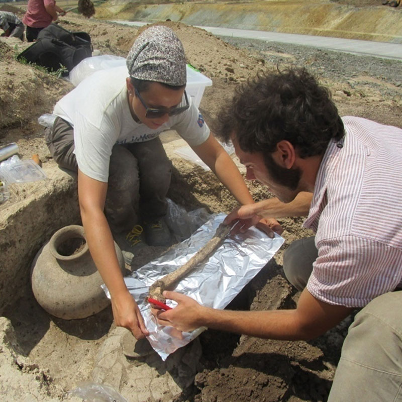
Year after year, the Ca’ Foscari team is bringing to light various portions of the settlement, which allow us to outline the history of the ancient insula Equilus in a completely new way: from the construction of a mansio in the 4th-5th centuries, followed in the 7th century by a cemetery extending north of the Cattedrale di S. Maria, to the discovery of the structures of the mid- medieval settlement, in particular around the church of San Mauro, founded in the 8th century and rebuilt in the 11th century on the banks of the lagoon canal of the same name. The long history of Equilus is also well represented by the numerous finds and the wealth of preserved bioarchaeological remains (animal bones and malacofauna, seeds and pits, beams and poles of wooden foundations, in addition to human remains from various cemetery areas).
In the near future, we intend to further expand interdisciplinary research through non-destructive analyses using state-of-the-art drones for detailed mapping of the site and surrounding area.
The marble routes
Marble Maritime Trade in the Roman Age
The project, started in 2009 and carried out in collaboration with the LAMA laboratory of the IUAV and the Soprintendenza del Mare della Sicilia, is aimed at reconstructing the marble routes in the ancient world and the characteristics of the vessels that transported these exceptional loads through the study of wrecks.
Archaeometric analyses of the marbles sampled underwater allow the recognition of the exact origin of the stones, while the use of underwater photogrammetry guarantees 3D surveys of the sites useful for the reconstruction of the cargoes.
To date, the Calabrian sites of Secca di Capo Bianco and Punta Scifo D and the Sicilian wrecks of Marzamemi, Isola delle Correnti, Capo Granitola and Capo Taormina, the Tuscan site of Secca della Meloria and the Sardinian wrecks of Punta del Francese and Porto Cervo have been analysed.