Digital cultural heritage and digital and public archaeology
Digital data and public(s) are deeply connected, and nowadays archaeologists and cultural experts are not only asked to build set of coherent digital data from the surveys, but they have to foster methods for engaging new audiences and facing the global societal challenges. Digital tools may help the de-colonization of the archaeological practice, going beyond the mere reconstruction of the past and being able to detect and analyze the cultural and political frameworks by which we share and perpetuate the memory. Specific sectors of the area:
- Digital Tools, Methods and Resources for GLAM & Archaeology (Galleries, Libraries, Archives, Museums, Archaeological Sites)
- Cultural Heritage Digitization (Imaging Technologies, 3D, RTI)
- Material Analysis & Data Processing (Imaging Processing, Pattern Recognition, OCR, HTR, Statistical Analysis)
- Documentation, Information Retrieval & Data Visualisation (GIS, Gazetteers & Atlases, Formal Descriptions, Digital Catalogues, Virtual Reality, Virtual Archives & Collections)
Fellowship projects
Venice Rivers Collection
Carried out by Elisa Corrò
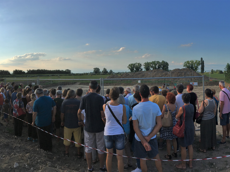
The outcome of the project Venice Rivers Collection (on how rivers in the Venice area changed over the centuries) is to provide digital solutions and public events as a way to engage communities into their past.
The project is carried out by Elisa Corrò, a geoarchaeologist focusing on digital tools to analyse archaeological and geomorphological data, and to highlight, visualise and communicate the influences of environmental conditions on human behaviour.
MapAeg Project
Carried out by Benedetta Bessi
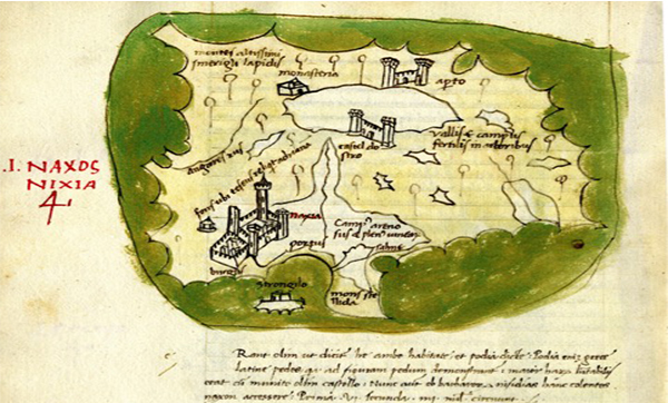
MapAeg is a 3-year Marie Skłodowska-Curie project aimed at the study of the "Liber Insularum Archipelagi"(1420) by the Florentine traveler Cristoforo Buondelmonti. This book can be considered the first guide to the Greek islands, each of them described by a textual paragraph and illustrated by color maps, in a format which gave rise to the new literary genre of Isolaria. In addition to offering precious information on the specific islands, the Liber occupies a relevant role in history of European cultural heritage as the travels of Buondelmonti paved the way to the rediscovery and exploration of Greece, a land whose territory, language and culture were still largely unknown to the Western European scholars. An important component of the project is represented by the creation of a digital edition of the text based on a manuscript copy of the Liber kept in the Gennadios Library (MS Gennadios, Athens 71) and accompanied by an English translation and a detailed historical and archaeological commentary. The publication will follow a progressive/incremental digital model providing successively the results of the research embedded in an digital environment giving access to facsimles, transcripts, electronic/OCR text versions of previous relevant editions, digital maps and visualisations of archeological data. This comprehensive, yet modular approach and the use of standard formats for metadata, textual, images-related and archaeological information ensures their findability, access, integration, analysis and future re-use in subsequent / follow up research projects dealing with Buondelmonti.
Member / Department of Humanities projects
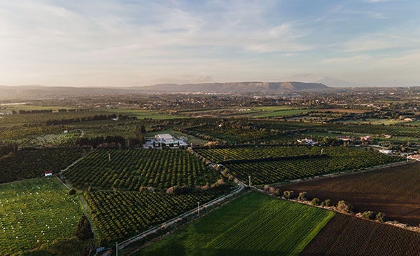
MAS: Mapping Ancient Sicily
Principal investigator: Stefania De Vido
Researcher: Valentina Mignosa
Website: MAS: Mapping Ancient Sicily (IX-V BCE)
Status: ongoing
Mapping Ancient Sicily (MAS) was born out of the need to study ancient Sicily holistically. MAS attempts to overcome the boundaries between disciplines and the fragmentation of evidence. But it also stems from the desire to represent this research on a map and through a user-friendly tool capable of responding to the needs of historical research. The project (PI: Stefania De Vido) is financed by Ca’ Foscari University of Venice and involves a historian and digital humanist (Valentina Mignosa) and the collaboration of a computer engineer (Garth Henning) and a historian with expertise in GIS (Massimiliano Grava).Through the use of GIS(Geographic information system)-based time-geographic methods as the representational framework and the most recent conceptual developments in deep mapping, MAS aims to unfold spatial and temporal visualisations of the history of different areas of Sicily. To do this, we have worked with both the QGIS (Quantum Geographic information system) application and a new tool implemented from the Running Reality (RR) application. Visit our MAS StoryMap for more insights on our pilot project MAS 1.0.
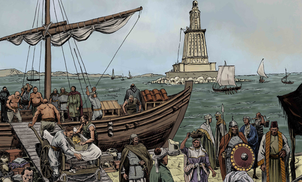
Before Marco Polo. The Origin of Venice
Principal investigator: Sauro Gelichi (in cooperation with Stefano Gasparri, Elisa Corrò, Carlo Beltrame, Claudio Negrelli and Francesca Zamborlini)
Status: ongoing
Video produced on the occasion of the Exhibition "Venice and Suzhou. Water Cities along the Silk Roads". The video, about 8 minutes long, illustrates the urban landscape of Venice before the year 1000, reconstructed thanks to archaeological and written sources. The video was made starting from drawings by Francesca Zamborlini (cartoonist), which describe the city of Venice and tells, along with historical events such as the stealing of the relics of St. Mark and the clashes with the Narentan pirates, some episodes of the life of Duke Justinian Partecipazio and the usurper Caroso.
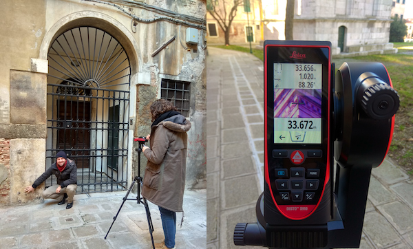
DigiLAnd: The Stones of Venice: a Digital Landscape
Principal investigator: Lorenzo Calvelli, Luigi Sperti
For the first time ever, this project intends to carry out accurate measurements of Greek and Roman artefacts, which feature as architectural elements in Venice and are difficult or impossible to access. Using last generation laser distance measuring equipments and their P2P (Point to Point) technology, we aim to get precise digital representations of ancient columns, capitals or inscriptions, which are reused in the facades of palaces on the Grand Canal, as well as inside and outside Venetian churches and bell-towers. The scientific potential of this project may lead to significant developments in the study of reused sculptures (spolia). Indeed, such technology could be used to carry out even faster and larger scale measurements, paving the road for new powerful and groundbreaking ways of studying and teaching Classical Archeology and Epigraphy.
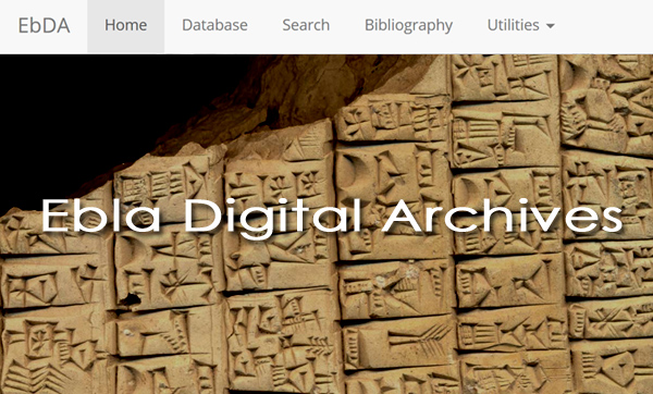
Ebla Digital Archives
Principal investigator: Lucio Milano
Website: ebda.cnr.it/
Status: ongoing
Based on a partnership with the Ebla Archaeological Mission, the Ebla Digital Archives project aims to provide a digital edition of the entire corpus of cuneiform texts from Ebla (ancient Tell Mardikh, Syria), dated to the 24th century BCE. It includes all documents published so far in the “Archivi Reali di Ebla – Testi” series, as well as in other monographs and journals. Compared with hard copy publications, the digital edition offers harmonized transliterations, corrections and numerous collations. The Ebla Digital Archives project provides scholars and students alike with an easy-to-use, yet powerful research tool for the study of the Ebla texts. Users may browse the documents individually, or query data in the most flexible way, thanks to one of the most advanced database implementation for the digital representation of cuneiform documents. An extensive, searchable, up-to-date bibliography of all Ebla material published so far complements the results.
Interview (in Italian language) to Sauro Gelichi (full professor of Medieval Archaeology at Ca' foscari University and Director of CESAV) for the VenetoNight 2019
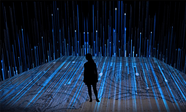
Living Venice in the past: urban landscape and everyday life during the middle ages
Principal investigator: Sauro Gelichi (in cooperation with Stefano Gasparri, Elisa Corrò, Margherita Ferri, Carlo Beltrame, Claudio Negrelli)
Status: on going
Archaeological and historical research has changed the way we imagine and understood Venice in the early Middle Ages. In Venice, however, there is no place that can tell this new narrative with images and objects.
The aim of this project is to produce a path in order to enhance the living experience for different targets, to be inserted in an online platform, free and accessible. The ‘immersive’ content will be flexible, focused on interactivity, reconstructions, digital stories with virtual solutions, as 360 degree video and applications.
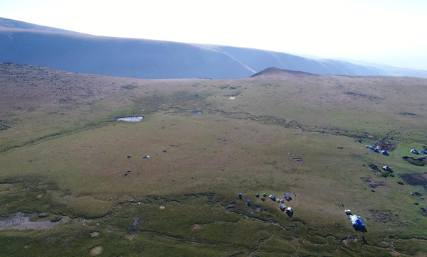
Mappa archeologica 3D di Kamir Sar (Armenia)
Principal investigator: Alessandra Gilibert
Status: about to start
This action aims at producing a 3D digital map of the archaeological site of Karmir Sar, Armenia, panoramically located at 2850m asl on Mount Aragats, Here, a great number of prehistoric monuments have been found, including twelve 6000-years old steles decorated with animal reliefs that are among the oldest figurative monuments of the ancient Near East. The digital map will be generated through aerial photogrammetry and will support the comparative analysis of spatial data, implement virtual explorations, integrate georadar analysis and help public understanding of the site.
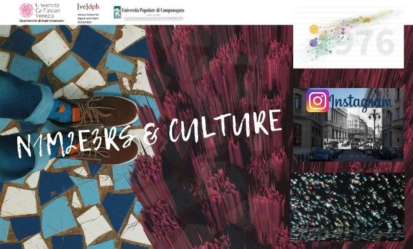
Numbers&Culture
Principal investigator: Sauro Gelichi (in collaboration with Elisa Corrò, Alessandro A. Rucco, Eleonora Delpozzo, Sofia Antonello, Humanities for Change)
Status: ongoing
The project aims to promote Cultural Heritage fostering the contamination between academic world and community. Numbers & Culure involves some schools belonging to different municipalities in the Città Metropolitana di Venezia, in collaboration with Università Popolare di Camponogara. The challenge focuses on an interdisciplinary research that includes: an open data search on the web as a way to describe with numbers the features of the present landscape; a collection of historical memories; a past-present comparison of the landscape changes by uploading pictures on the Instagram channel of the project. Thanks to a team of researchers, in the VeDPH each class will analyse their research data in real time, with a series of data visualization processes. The collection of information will be used to map and to increase the value of cultural assets.
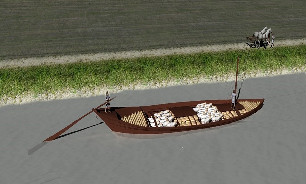
Digital hydrostatic study and cargo capacity of the late antique river boat of Santa Maria in Padovetere (Comacchio)
Principal investigator: Carlo Beltrame, Elisa Costa
Status: ongoing
The project is a step of an ongoing study on the 5th century AD boat of Santa Maria in Padovetere, in Comacchio (FE), by Carlo Beltrame and Elisa Costa. The good conservation of the wood of the boat excavated in 2014 and 2015, permit to modelling and reconstruct the original shape of the hull. This step consists in the hydrostatic study and calculations on the 3D model; starting from the weight of the hull, calculated on the different essences of the wooden elements, and hypothesizing the type of cargo on the basis of archaeological finds, it will be possible to hypothesize the minimum and maximum capacity of cargo and its arrangement, it will be possible to calculate the waterline and then analyse the navigability of the boat, evaluating the timing and characteristics of river navigation.