
Civil Protection: Digital Plans and Low-Cost Sensors for more Resilient Communities



Preventing the devastating impacts of extreme weather and climate-related events also requires ensuring a prompt, coordinated civil protection response: turning civil protection plans into updatable digital tools, linking them to data collected on the ground, and making them more accessible to the public and operational staff. This is the model tested by Digital Plan, a project funded by the Interreg Italy-Croatia Programme, which concludes on 31 August 2026 after 30 months.
The project involved four Italian and four Croatian partners and used the municipalities of Busso and Montagano in Molise, Maiella National Park in Abruzzo, the municipality of Fermo in the Marche region, Zadar County, the City of Dubrovnik, and Split-Dalmatia County as pilot areas.
The main output is a digital platform that enables users to browse maps, documents, risks and monitoring data transmitted in real time by Internet of Things (IoT) sensors. Authorised staff can also update plans, manage map layers, configure alert thresholds and receive notifications.
From documents to digital maps
Digitalisation transforms information such as risk areas, strategic buildings, infrastructure, access routes and assembly points into searchable, accessible and updatable map layers.
For the Italian pilot areas, Digital Plan followed the Operational Guidelines approved by Decree No. 265 of 29 January 2024 of the Head of the Italian Civil Protection Department, which set out standards for the digitalisation and interoperability of civil protection plan data. The Italian framework served as a reference point for collaborations with Croatian municipalities, exploring a common approach across the Adriatic that can be tailored to various administrative settings
Ca’ Foscari University of Venice coordinated the digitalisation of the plans and contributed to defining common data structures and procedures. Together with the University of Split, it also designed the IoT platform and decision support system.
«Digital Plan has enabled us to test in the field how a civil protection plan can become a dynamic tool, fed by up-to-date data and usable both in preparedness and during an emergency,» explains Giovanni Antonio Salvatore, Professor of Electronics at Ca’ Foscari University of Venice. «The result is a replicable model. Authorities can start from their existing plans, organise information according to shared standards and expand the system over time by adding new data and sensors.»
Three pilot projects in Molise, Abruzzo and the Marche
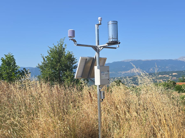
In Molise, two environmental monitoring stations have been installed in the municipalities of Busso and Montagano. They transmit data to the platform, enabling the testing of thresholds and notifications in inland areas exposed to extreme weather events.
In Maiella National Park, testing covers Lama dei Peligni, Caramanico Terme and Pratola Peligna, with particular attention to risks such as wildfires, avalanches and landslides.
In Fermo, a network has been established to monitor flood and hydrogeological risks, including weather stations, water-level sensors on watercourses, and level sensors in underpasses that are particularly vulnerable to flooding. When limits are exceeded, alerts are sent through the platform, and in certain areas, warning lights can be triggered to enhance road safety
A network complementing existing monitoring systems
Digital Plan's low-cost sensors installed by Digital Plan complement existing environmental and weather stations, boosting observation and enabling tracking of localised phenomena. The value of this data is enhanced when it is integrated with risk maps and other plan-related information, making it accessible to both the public and operational teams.
Skills that remain in local communities
Digital Plan has trained local staff to use the platform, update plans and maps, interpret sensor data, configure monitoring thresholds, and integrate new sensors. The authorities involved will therefore be able to continue updating the system after the project ends. The platform is also designed to accommodate additional civil protection plans and new monitoring stations.
The project
Digital Plan (Civil Protection Plan Digitalization through Internet of Things Decision Support System based Platform) is funded by the Interreg Italy-Croatia Programme 2021-2027. The project runs for 30 months, from 1 March 2024 to 31 August 2026, and has a total budget of EUR 2,665,725.35.
The project is coordinated by Molise verso il 2000 – GAL Molise. The partners are the Agency for Rural Development of Zadar County – AGRRA, Maiella National Park, Ca’ Foscari University of Venice, the City of Dubrovnik, RERA SD – Public Institution for Coordination and Development of Split-Dalmatia County, the University of Split and the Municipality of Fermo.
The public platform is available online at digitalplan.cloud/plans-showcase